
-
KC Regional Trail Map
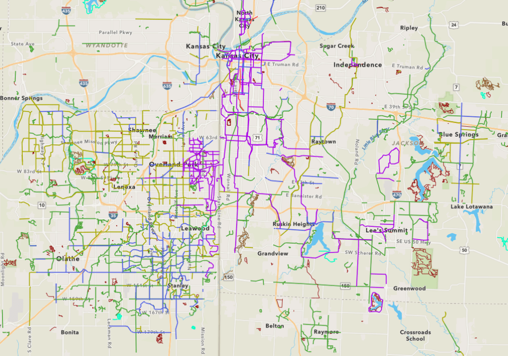
Have you ever wished for a regional map that shows the location, type, and purpose of trails in the KC metro area. Did you know that this trail map exists? Take a look here! ARCGIS is a tool used for surveying and land tracking. Kansas City keeps a record of all trails in the metro…
-
Wirelessly Send Ride With GPS to Garmin Edge
Hey Friends! Here’s a short video on how to transfer your favorite Ride with GPS route to your Garmin Edge 500+ series bike computer without connecting it to your computer.
